. 2025 Feb 12;20(2):e0313409.
doi: 10.1371/journal.pone.0313409. eCollection 2025.

Early to Mid-Holocene land use transitions in South Asia: A new archaeological synthesis of potential human impacts

Affiliations

Early to Mid-Holocene land use transitions in South Asia: A new archaeological synthesis of potential human impacts

J Bates et al. PLoS One. .

Abstract

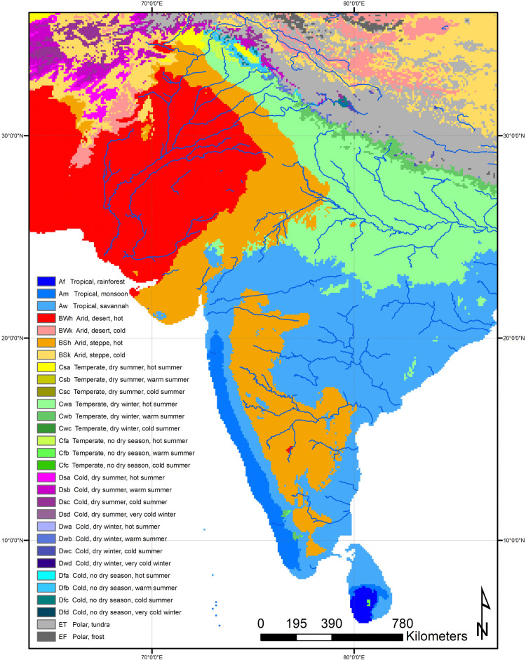
While it is clear that current human impact on the earth system is unprecedented in scope and scale, much less is known about the long-term histories of human land use and their effects on vegetation, carbon cycling, and other factors relevant to climate change. Current debates over the possible importance of human activities since the mid second millennium CE cannot be effectively resolved without evidence-based reconstructions of past land use and its consequences. The goal of the PAGES LandCover 6K working group is to reconstruct human land use and land cover over the past 12,000 years. In this paper, we present the first large-scale synthesis of archaeological evidence for human land use in South Asia at 12 and 6kya, a critical period for the transition to agriculture, arguably one of the land use transitions most consequential in terms of human impact on the Earth system. Perhaps the most important narrative we can pick out is that while there are some shifts in land use across these time windows, hunter-gatherer-fisher-foraging remained the dominant land use, and within this there was a mosaic of strategies exploiting diverse and complex landscapes and ecologies. This is not necessarily a new conclusion-it is not new to state that South Asia is comprised of many niches, but demonstrating the deep time history of how people have adapted to these and adapted them is an important step for modelling the impacts of human populations and thinking about their footprints in a longue-durée perspective. Despite the new development of food production between the early and mid-Holocene by overall area foraging life ways continued as the dominant land use practice into the 6kya time window. The development of agriculture and food production was not unimportant-it is the beginning of a land use that eventually comes to dominate the sub-continent, but at 6kya agriculture was restricted to specific contexts. Across 12kya to 6kya and different land uses, the use of mosaic ecologies, diverse strategies and the importance of water as a resource stand out as shared themes.


Conflict of interest statement

The authors have declared that no competing interests exist.

Figures

Fig 1
Fig 1. Environmental Köppen Geiger classes for South Asian subcontinent [20].
Figure created from data under a Creative Commons Public Domain Dedication CC BY 4.0: Beck, H. E. et al. Figshare https://doi.org/10.6084/m9.figshare.6396959 (2018).
Fig 2
Fig 2. Nested hierarchies of the PAGES LandCover6k land use classification system.
(reproduced from [14]: Fig 1). Reprinted from (14) under a CC BY 4.0 license, with permission from PlosONE, original copyright 2021.
Fig 3
Fig 3. Comparison of Paleolithic sites (45-20kya), with 12k and 6k time windows.
There are notably fewer sites in both the 6k and 12k time windows than in the pre-20k time period, with particular clusters in 12k and 6k that are discussed below. Created by authors using base maps from Esri. Base map image(s) is the intellectual property of Esri and is used herein under license. Copyright © 2020 Esri and its licensors. All rights reserved. Sources for base maps: Esri, GEBCO, NOAA, National Geographic, DeLorme, HERE, Geonames.org, and other contributors.
Fig 4
Fig 4. Land use map at 12kya (12,250–11,750 years ago).
There is a notable spread of LU1 HHGF across the majority of the subcontinent, with patches of minimal-extensive and small points of LU2 LLFP. Note the difference in sea-level between 12k and the modern coastline creating different potential land to use (e.g.: Sri Lanka-mainland land bridge). Inset A shows Maldives, which are included at 12k due to the lower sea levels creating a greater coastline. As will be apparent by 6k, when sea levels rise to reach modern levels, such land masses no longer provide enough area to merit their inclusion within the land mass grid. At 12k though they form a large enough landmass due to lower sea levels, but present no evidence for human land use. Map made by authors using ArcGIS and LC6k database.
Fig 5
Fig 5. Land use at 6kya (6,250–5,750 years ago).
LU1 HHGF remains the dominant land use across the subcontinent, with a slight decrease in minimal-extensive and some increase in LU2 categories. Diversity in the forms of land use therefore seem to increase by 6k, but HGFF remains the main land use across South Asia. It is also important to note the change in sea level to those similar to today, changing the available land from that in 12k to that recognizable today. Map made by authors using ArcGIS and LC6k database.
Fig 6
Fig 6. Details of Land Use at 6kya.
A) Excerpt map for Indo-Iranian borderlands and Gujarat, showing the diversity of land use within this north west region of South Asian the 6kya time window (6,750–5,5750 years ago). LU1 agriculture and LU2 herbaceous ground crops can be seen in the alluvial fans in this zoomed in excerpt, as can the broad-based marine/aquatic resources along the Gujarat coast, along with areas of LU1 agriculture. B) Excerpt map for Ganges Plains at 6kya. Areas of LU1 HGFF LU2 LLFP can be seen in this zoomed-in map. Map made by authors using ArcGIS and LC6k database. C) Excerpt map of Sri Lanka at 6kya, showing the prevalence of LU2 broad based and/or marine/aquatic resources along the coastlines. The continued presence of LU1 HGFF LU2 LLFP in the Horton Plains is also highlighted. Maps made by authors using ArcGIS and LC6k database.
Fig 7
Fig 7. Data coverage and data quality maps.
Top left is data coverage at 12kya, top right is data quality at 12kya. Bottom left is data coverage at 6kya, bottom right is data quality at 6kya. Data coverage has been estimated by putting a raster interpolation on site data for both 12kya and 6kya to create density buffers at 30km to take into account survey work around sites. Data quality was mapped using the 8x8km grid square system of the LC6k database. Map made by authors using ArcGIS and LC6k database.

References

    1. Boivin NL, Zeder MA, Fuller DQ, Crowther A, Larson G, Erlandson JM, et al.. Ecological consequences of human niche construction: Examining long-term anthropogenic shaping of global species distributions. Proc Natl Acad Sci. 2016;113: 6388–6396. doi: 10.1073/pnas.1525200113 - DOI - PMC - PubMed
    1. Ellis EC, Gauthier N, Klein Goldewijk K, Bliege Bird R, Boivin N, Díaz S, et al.. People have shaped most of terrestrial nature for at least 12,000 years. Proc Natl Acad Sci. 2021;118: e2023483118. doi: 10.1073/pnas.2023483118 - DOI - PMC - PubMed
    1. Harrison SP, Gaillard M-J, Stocker BD, Vander Linden M, Klein Goldewijk K, Boles O, et al.. Development and testing scenarios for implementing land use and land cover changes during the Holocene in Earth system model experiments. Geosci Model Dev. 2020;13: 805–824. doi: 10.5194/gmd-13-805-2020 - DOI
    1. Balter M. Archaeologists Say the “Anthropocene” Is Here—But It Began Long Ago. Science. 2013;340: 261–262. doi: 10.1126/science.340.6130.261 - DOI - PubMed
    1. Ellis EC. Ecology in an anthropogenic biosphere. Ecol Monogr. 2015;85: 287–331. doi: 10.1890/14-2274.1 - DOI

Publication types

LinkOut - more resources