

Range-Wide Camera Trapping for the Australian Cassowary Reveals Habitat Associations With Rainfall and Forest Quality
- PMID: 40469466
- PMCID: PMC12134640
- DOI: 10.1002/ece3.71464
Range-Wide Camera Trapping for the Australian Cassowary Reveals Habitat Associations With Rainfall and Forest Quality
Abstract
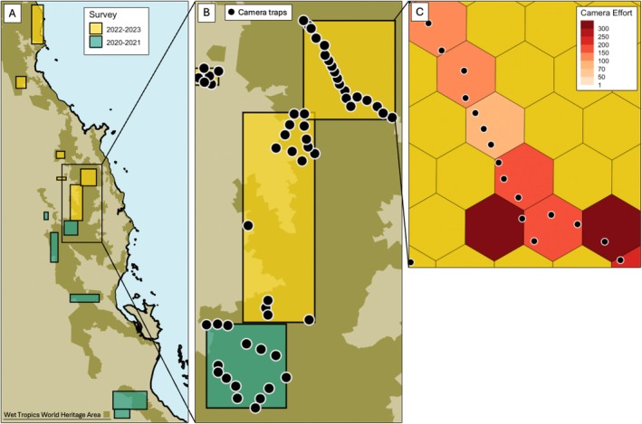
The Australian Wet Tropics rainforests are a biodiversity hotspot covering just 0.2% of the continent's land area. However, historic forest loss, modern fragmentation, and climate change continue to threaten these ecosystems. Southern cassowaries (Casuarius casuarius) are large flightless birds restricted to closed-canopy tropical forests in Australia. Cassowaries are obligate frugivores whose dispersal of large-seeded plants is considered a keystone species interaction supporting forest regeneration. We conducted camera trapping across cassowaries' Australian range and quantified habitat associations using hierarchical models that account for imperfect detection. Cassowary detections were significantly higher in rainforests compared to adjacent wet sclerophyll closed-canopy forests, confirming their status as habitat specialists. Cassowaries' relative abundance (λ in Royle-Nichols modelling) declined with forest degradation and rainfall but was not strongly affected by human footprint or elevation. This aligns with observations of them occasionally foraging on anthropogenic food sources at the edges of large intact forests (e.g., where there are human-planted fruit trees). These findings provide the ecological reasons underpinning known cassowary hotspots in large rainforests that are relatively dry. It would be valuable to deepen our understanding of their persistence in degraded rainforests near humans via diet and survival studies, and we caution that their association with rainfall means that they may be impacted by climate change.
Keywords: abiotic factors; anthropogenic disturbances; bird; conservation; detectability; hierarchical modelling; interactive effects; occupancy; species distribution modelling.
© 2025 The Author(s). Ecology and Evolution published by British Ecological Society and John Wiley & Sons Ltd.
Conflict of interest statement
The authors declare no conflicts of interest.
Figures


References
-
- Andy, L. 2021. “‘Tourist Fiction’: Cassowaries in Mission Beach.” Queensland Review 28: 183–186.
-
- Bertram, B. C. R. 2014. The Ostrich Communal Nesting System, 1. Princeton University Press.
-
- Betts, M. G. , Wolf C., Pfeifer M., et al. 2019. “Extinction Filters Mediate the Global Effects of Habitat Fragmentation on Animals.” Science 366: 1236–1239. - PubMed
LinkOut - more resources
Full Text Sources
