

Cognition-enhanced geospatial decision framework integrating fuzzy FCA, surprisingly popular method, and a large language model
- PMID: 40593155
- PMCID: PMC12215947
- DOI: 10.1038/s41598-025-06508-6
Cognition-enhanced geospatial decision framework integrating fuzzy FCA, surprisingly popular method, and a large language model
Abstract
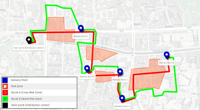
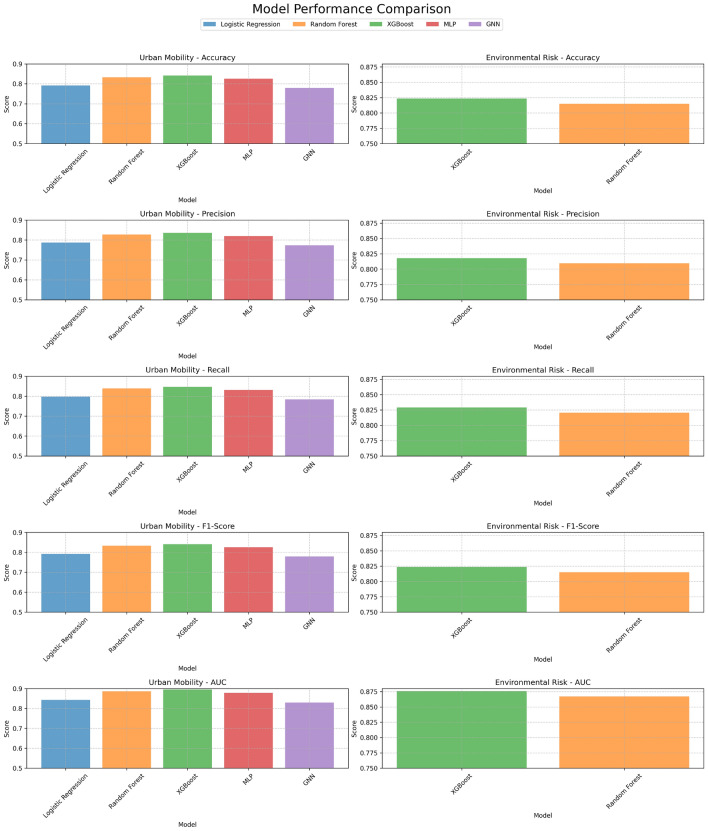
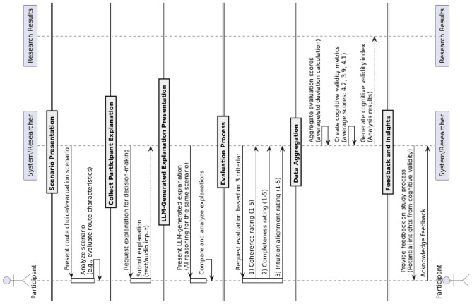
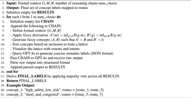
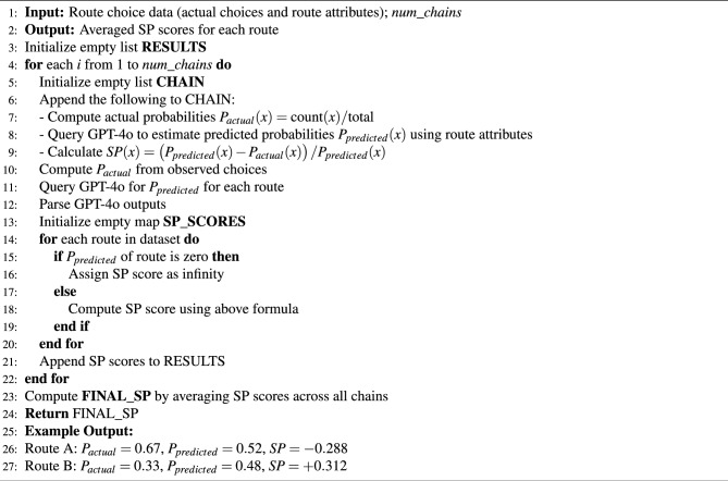
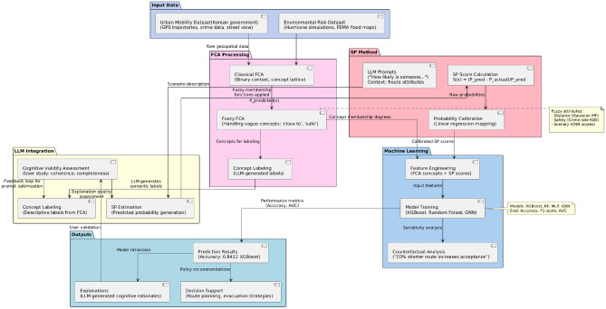
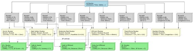
This study introduces a cognition-enhanced framework for geospatial decision-making by integrating Fuzzy Formal Concept Analysis (FCA), the Surprisingly Popular (SP) method, and a Large Language Model (GPT-4o). Our approach captures cognitive influences that are often overlooked in traditional geospatial analyses. Fuzzy FCA is used to extract interpretable concept hierarchies from spatial data, while the GPT-4o model estimates SP scores, identifying choices that reflect underlying cognitive biases. These cognitively informed features are combined within machine learning models, improving both prediction accuracy and interpretability. Experiments on real-world urban mobility and environmental risk scenarios demonstrate significant performance gains, with models like XGBoost achieving an accuracy of 0.8412. We also introduce a novel method for evaluating the cognitive validity of LLM-generated model explanations, which involves assessing how well these explanations align with human intuition and reasoning. Our results show that incorporating cognitive elements into geospatial models not only improves outcomes but also bridges the gap between data-driven predictions and human decision-making. This framework offers broad potential for applications in GIS, urban planning, and environmental management.
Keywords: A large language model; Cognitive bias; Formal concept analysis; Geospatial decision-making; Surprisingly popular method.
© 2025. The Author(s).
Conflict of interest statement
Declarations. Competing interests: The authors declare no competing interests.
Figures
References
-
- Mai, G. et al. Towards the next generation of geospatial artificial intelligence. Int. J. Appl. Earth Obs. Geoinf.136, 104368. 10.1016/j.jag.2025.104368 (2025). - DOI
-
- Ali, U. et al. A data-driven approach for multi-scale gis-based building energy modeling for analysis, planning and support decision making. Appl. Energy279, 115834. 10.1016/j.apenergy.2020.115834 (2020). - DOI
-
- Basu, N., Oviedo-Trespalacios, O., King, M., Kamruzzaman, M. & Haque, M. M. What do pedestrians consider when choosing a route? the role of safety, security, and attractiveness perceptions and the built environment during day and night walking. Cities143, 104551. 10.1016/j.cities.2023.104551 (2023). - DOI
MeSH terms
Grants and funding
LinkOut - more resources
Full Text Sources
Miscellaneous
