

Geospatial dataset on deforestation and urban sprawl in Dhaka, Bangladesh: A resource for environmental analysis
- PMID: 40655986
- PMCID: PMC12246851
- DOI: 10.1016/j.dib.2025.111786
Geospatial dataset on deforestation and urban sprawl in Dhaka, Bangladesh: A resource for environmental analysis
Abstract
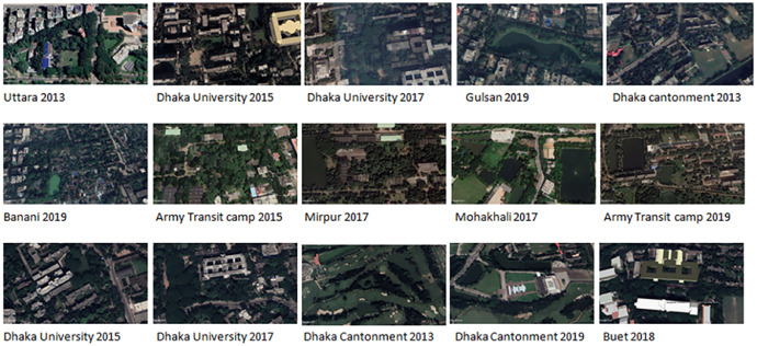
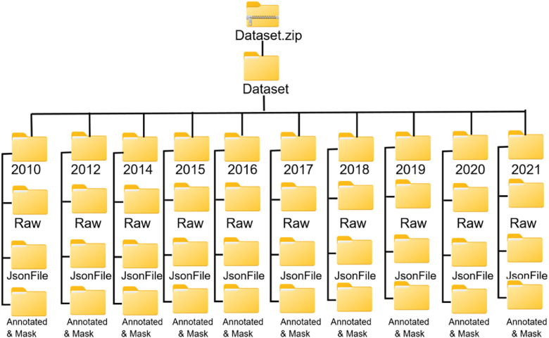
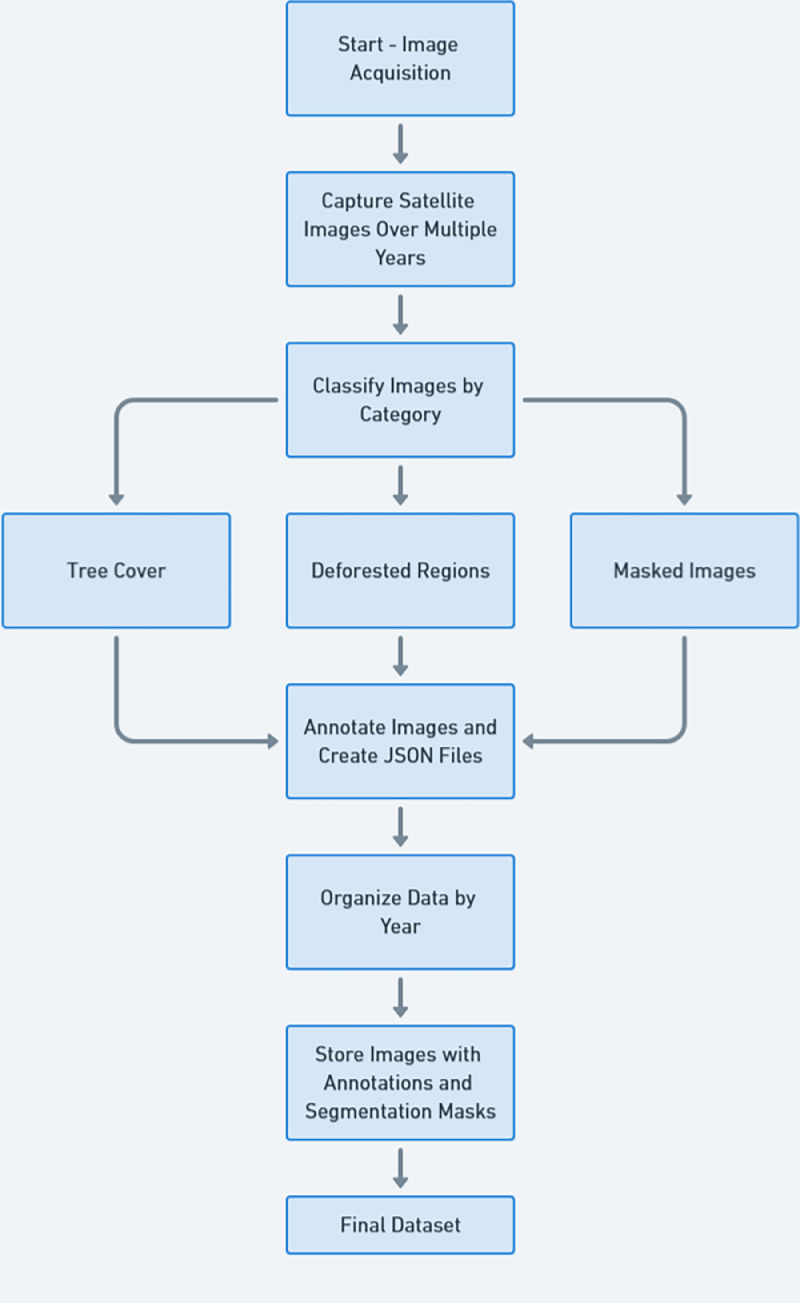
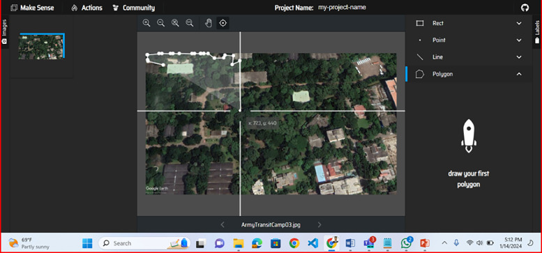
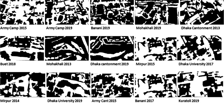
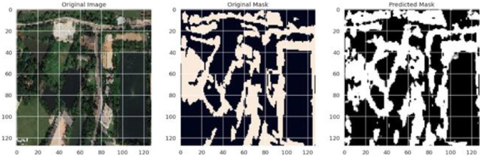
This dataset comprises high-resolution satellite images for monitoring deforestation in Dhaka, Bangladesh. Data were acquired via Google Earth Pro from fixed locations to maintain consistency in observing tree cover alterations. Each image includes annotations and JSON mask files that delineate tree cover and deforested areas. The dataset facilitates machine learning applications, including object detection, semantic segmentation, and change detection. Image resolution and aspect ratio vary, with 5-35 images recorded per location annually over a decade. This data serves researchers investigating urbanization's environmental impact and the gradual reduction of tree cover in a rapidly evolving urban environment. Utilizing the annotations and masks enables the training of machine learning models to identify and forecast vegetation changes, aiding environmental monitoring and conservation initiatives. Furthermore, the dataset is readily applicable for educational purposes in disciplines such as geography, environmental science, and machine learning. It provides critical insights into the application of machine learning and image processing in addressing real-world environmental issues.
Keywords: Computer vision; Deep learning; Image classification; Semantic segmentation.
© 2025 The Author(s).
Figures
Similar articles
-
Cauliflower leaf diseases: A computer vision dataset for smart agriculture.Data Brief. 2025 Apr 28;60:111594. doi: 10.1016/j.dib.2025.111594. eCollection 2025 Jun. Data Brief. 2025. PMID: 40534720 Free PMC article.
-
Leveraging a foundation model zoo for cell similarity search in oncological microscopy across devices.Front Oncol. 2025 Jun 18;15:1480384. doi: 10.3389/fonc.2025.1480384. eCollection 2025. Front Oncol. 2025. PMID: 40606969 Free PMC article.
-
Short-Term Memory Impairment.2024 Jun 8. In: StatPearls [Internet]. Treasure Island (FL): StatPearls Publishing; 2025 Jan–. 2024 Jun 8. In: StatPearls [Internet]. Treasure Island (FL): StatPearls Publishing; 2025 Jan–. PMID: 31424720 Free Books & Documents.
-
Home treatment for mental health problems: a systematic review.Health Technol Assess. 2001;5(15):1-139. doi: 10.3310/hta5150. Health Technol Assess. 2001. PMID: 11532236
-
Advancing respiratory disease diagnosis: A deep learning and vision transformer-based approach with a novel X-ray dataset.Comput Biol Med. 2025 Aug;194:110501. doi: 10.1016/j.compbiomed.2025.110501. Epub 2025 Jun 9. Comput Biol Med. 2025. PMID: 40494170
References
-
- Sajib A.M., Moniruzzaman Md. Driving forces of Landuse and landcover changes in the North-eastern part of Dhaka conurbation. Dhaka Univ. J. Earth Environ. Sci. 2022 doi: 10.3329/dujees.v10i2.57515. - DOI
-
- M. Rahman Md., Szabó G. Land; Bangladesh: 2021. Impact of Land Use and Land Cover Changes on Urban Ecosystem Service Value in Dhaka. - DOI
-
- Islam K.L., Sato N. Deforestation, land conversion and illegal logging in Bangladesh: the case of the Sal (Shorea robusta) forests. Iforest - Biogeosciences For. 2012 doi: 10.3832/IFOR0578-005. - DOI
-
- Sunderland T., Kibria M.G., Rahman S.A., Imtiaj A. Depleting tropical forest at a landscape scale: finding solutions for Bangladesh. Our Nat. 2011 doi: 10.35648/20.500.12413/11781/II273. - DOI
-
- Md. Jelas I., Zulkifley Mohd.A., Abdullah M., Spraggon M. Deforestation detection using deep learning-based semantic segmentation techniques: a systematic review. Front. For. Glob. Change. 2024 doi: 10.3389/ffgc.2024.1300060. - DOI
LinkOut - more resources
Full Text Sources
